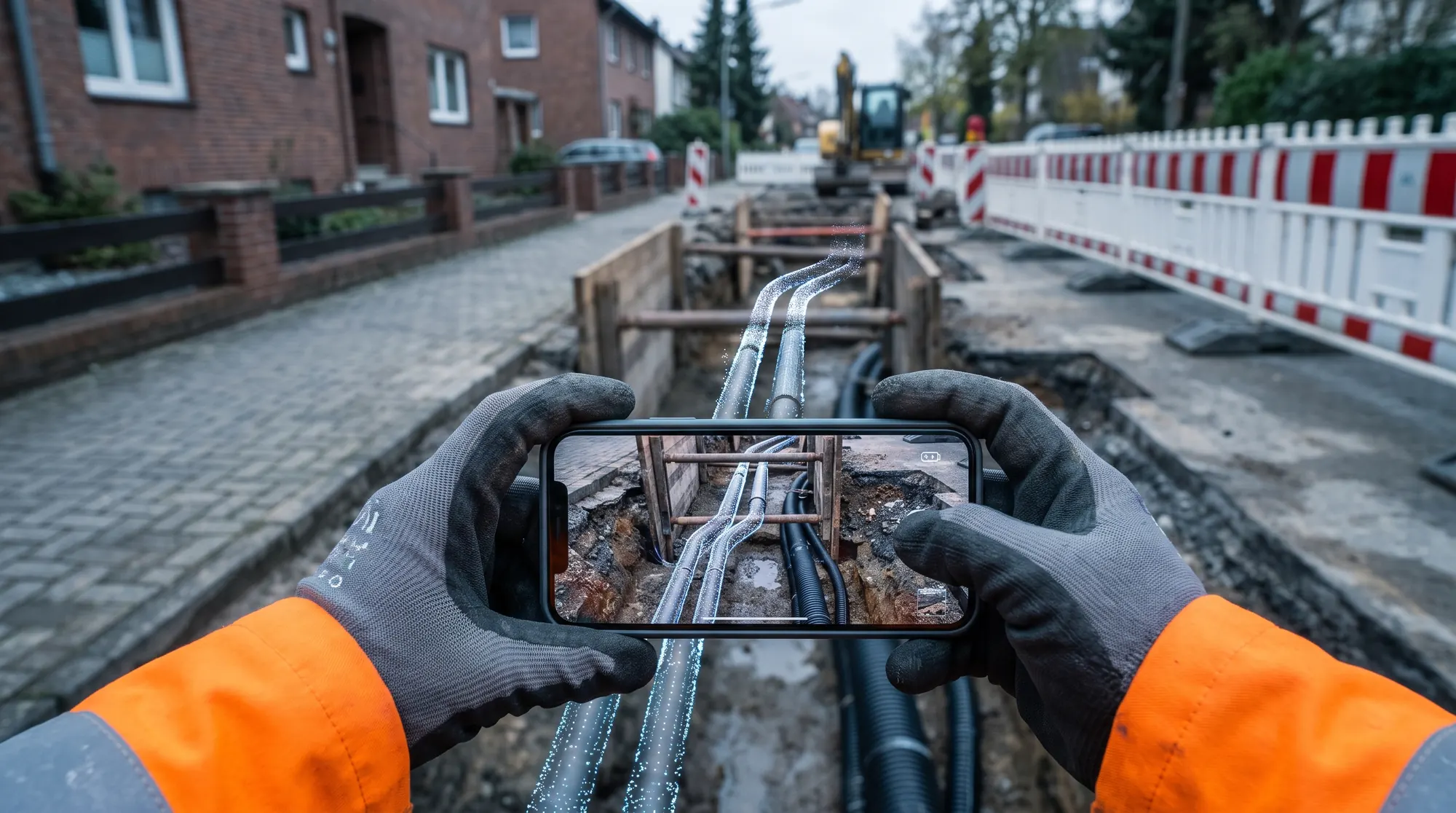
From video to CAD plan.
Built for the crews that open the trenches: district heating, water, power, gas and fiber.
Measuring what lies where still happens by hand.
- Weeks pass between completion and invoicing, and cash flow suffers.
- Site managers document late and reluctantly, so data arrives incomplete.
- Manual measurements are error-prone and don't hold up in disputes.
- As-built plans take months to arrive, sometimes up to a year.
- Surveyor, engineering office and rework in the back office: every handoff adds cost.
- Contractor invoices can't be checked against independent data.
A phone video delivers survey-grade 3D records.
No hardware. No on-site expert. No back office.
- Capture
The crew or site manager films the open trench in under ten minutes, then backfills right away.
- Process
sizeless processes the video fully automatically. No specialist needed.
- Deliver
Within 72 hours, all data is ready for planning, records and invoicing.
- 72 h
- from scan to results
- 1 visit
- one site visit instead of many
- 7 mm
- deviation from a professional survey
Excavation volume. Pipe isometry. Laying lengths.
- 01
Invoice sooner
Quantities ready for your invoice within days.
- 02
Less staff on site
No surveyor, no specialist. Every site manager can do it, and the process scales with your order volume.
- 03
Complete 3D evidence
Before backfilling: third-party lines, depths and dimensions.
Billing-ready documentation within days, VOB-compliant: excavation volume, laying lengths and isometrics, straight into your invoice.
Request a demo
As-built data in days instead of months.
- 01
3D mesh
A 3D reconstruction of the open trench, centimeter-accurate against tachymetry, georeferenced via GPS, control points, cadastral data and orthophotos.
- 02
2D CAD plan
As-built plans (DWG/DXF) to DVGW GW 120 and DIN 2425. Sleeves, bends and lines are detected automatically, and deviations from the plan become visible.
- 03
3D model & GIS
Every line in 3D with manufacturer, diameter and connection, ready for your GIS. Quantities like length, welds and bends come with it.
- 04
First visit with one person instead of four.
The planner gets the as-built as CAD and only plans the new line.
- 05
Fewer handoffs, verified quantities.
Check contractor invoices against the data from the scan.
- 06
Ready for operations.
Your network in 3D with manufacturer and diameter, the basis for network analysis, maintenance and incidents.
Every document the trench needs. From one video.
In the formats your planners, your GIS and your accounting already use. More formats such as Interlis will follow.
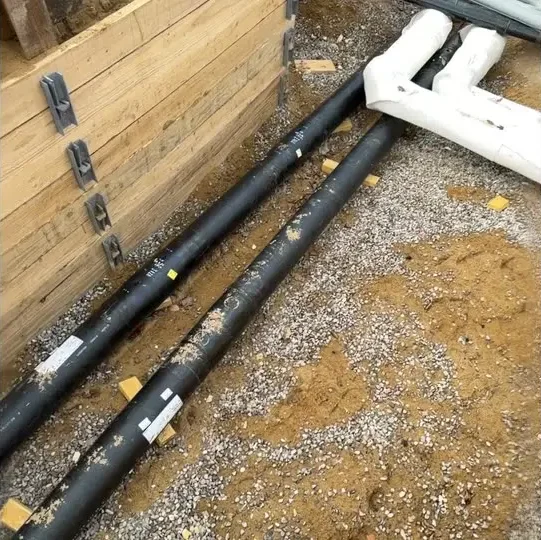
Centimeter-accurate point cloud and mesh of the open trench, including house entries and third-party lines. The objective basis for every drawing and every quantity that follows.
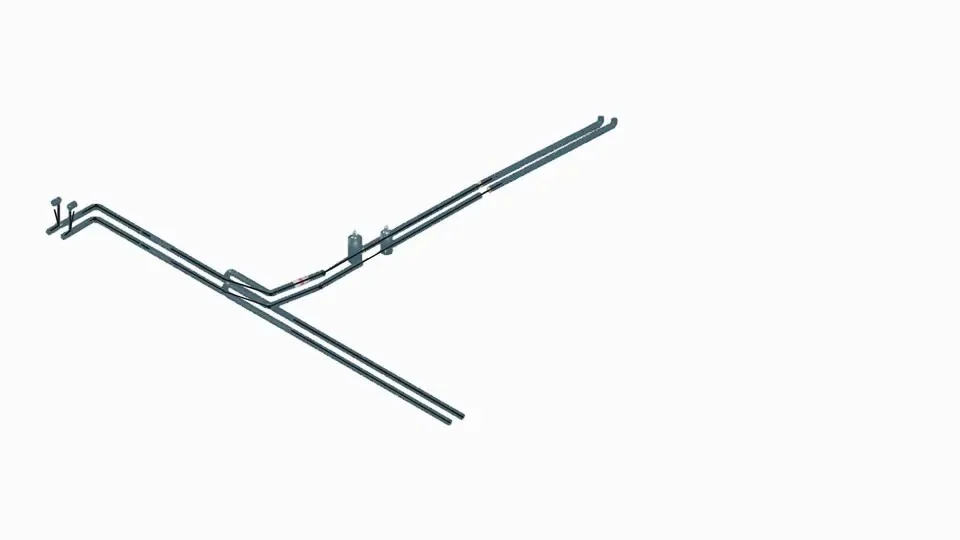
Every pipe, fitting, bend and dimension drawn from the scan – the as-built isometric your planners file today, without anyone drawing it by hand.
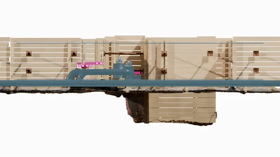
Depth, cover and the billing sections along the whole route, taken from the model instead of from a tape in the trench.
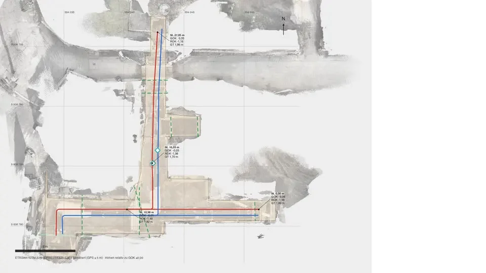
Georeferenced route with attributes, ready to drop into the network records and the operator's GIS.
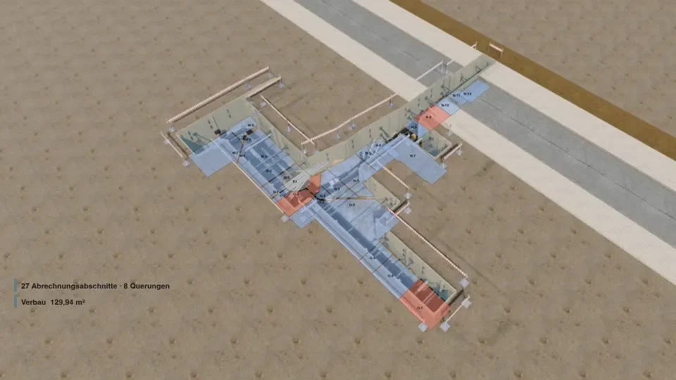
Excavation, shoring and materials per section – the figures the invoice is built on, available the day the trench is closed.
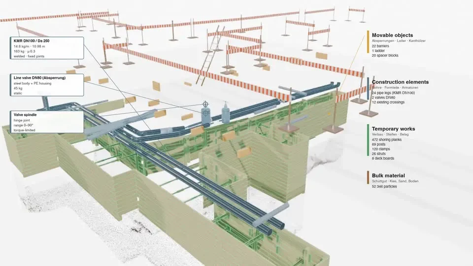
Pipe type, diameter, valves and the crew's voice notes, attached to the model. Everything the site knew, kept with the trench.
We turn smartphone videos into survey-grade 3D models.
- Our own SLAM
Survey-grade 3D from a single phone video, no extra hardware. A decade of research at ETH Zurich.
3D reconstruction - Semantic layer
Recognizes type, brand, material and connections.
Recognition - Conversational AI
The crew's spoken notes, captured in the scan.
Context
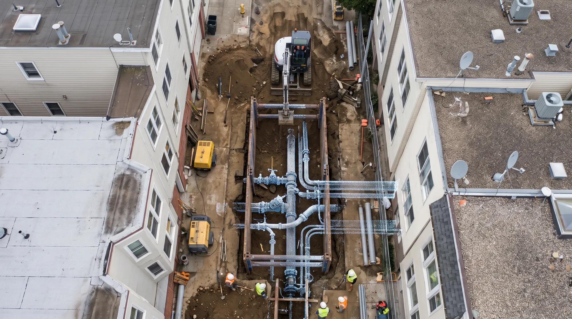
One trench is enough. We'll show you what comes out.
Scan with sizeless SiteScan, available on the App Store.